6.4.2 Connecting to a shapefile data source
- First, place the shapefile of the intended data source in a file location that can be accessed by your GeoServer instance. For the following example file location, a folder named ‘shapefiles’ was created to house shapefiles in the geoserver installation directory: %installLocation%\geoserver\data\shapefiles
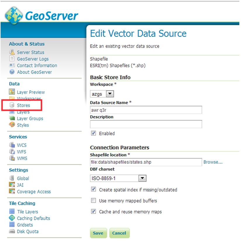
- On the New Data Source page, choose Shapefile as the source by clicking Shapefile. This will bring you to a New Vector Data Source page.

- In the Workspace drop down menu, select the workspace you created in the last step
- Type a name for your data store in the Data Source Name field.
- Add a description for the store, if desired. This description is for internal use only.
- Make sure that the Enabled checkbox is checked.
- Under Connection Parameters, click Browse... and navigate to the saved shapefile. The file will have to be accessible in the file system on the server that is hosting GeoServer.
- When finished, click Save.
At this stage you have configured a store of data (a shapefile) that is available to your workspace, but you have no actual layers; see section 6.5 for details of how to configure your layers.
Section last modified: 7 October 2015