6.3 Creating a workspace (and editing service metadata)
- After entering contact information for your GeoServer instance, you will need to create a workspace for your web service.
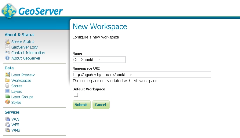
- On the left side of the GeoServer Web Administration Interface, under Data, click Workspaces. This will bring you to the Workspaces page, wherein you can manage existing workspaces and create new workspaces.
- Click Add New Workspace. This will bring you to the Edit Workspace page for your new workspace.
- Two fields are present on the Edit Workspace page:
- Name: The service title; may contain spaces or special characters, see notes below for further details.
- Namespace URI: A URI associated with your project; this can be any URI (and doesn’t have to resolve).
- When you are finished, click Save.

Give the workspace a memorable name; we suggest that this name is kept as short as possible because the workspace name is used throughout the service and is appended to all layer identifiers. The workspace name will also make up part of the URL for the service, for example:
http://127.0.0.1:8080/geoserver/OneGcookbook/wcs?
Note you can set up a proxy and configure Proxy URL base to achieve the desired OneGeology WMS profile URL name if required.
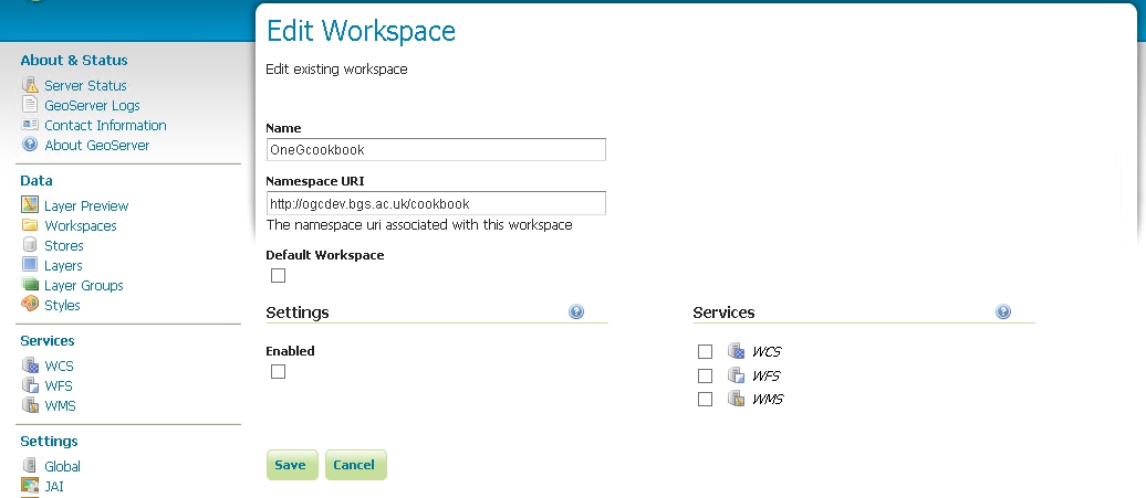
When you have created your workspace you can edit its properties. You will need to click the enabled box and also the WMS services option

Once you have Enabled the service, you will be able to edit the contact details for your service. By default you will have the standard metadata populated into this form. These metadata will be provided as part of the service GetCapabilities response.
See https://onegeology.org/wmsCookbook/2_4_1.html for details of required service level metadata
At the top of the page you need to add the service title and abstract, plus any constaints on use of the service and any access constraints. We recommned that you also select the strict CITE compliance option. The Online resource url listed in this section is not intended to be the URL of the service, but instead a URL to obtain further information on the service provider.

In the middle of the page you can configure a limited list of SRS for the service; it is recommended that you use this option otherwise you will get the full list of GeoServer supported coordinate reference systems (about 4100), which makes the capabilities document slow to parse. Remember you must support EPSG:4326 for the portal.

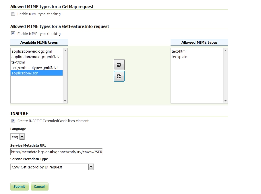
If you have added the INSPIRE extension plugin, at the bottom of the page you will be able to configure a scenario 1 style extended capabilities section. See the GeoServer documentation (https://docs.geoserver.org/stable/en/user/extensions/inspire/index.html) for further details.

Section last modified: 07 October 2015
