1.4.3 Using ESRI ArcGIS ArcMap (v9.3.1)
1.4.3.1 Using ArcCatalog
To add a WMS service to your list of available WMS services you use the GIS servers > Add WMS server option, and then add the Service URL (without parameters). You may select to use the default service version (which would normally be the highest version) or you may force a specified version depending on your needs.

If the map service is not scale layered (only visible at certain scales) you will be able to preview the service layers. Similarly if the layers are queryable you will be able to use the information tool to retrieve feature information.
You will not be able to view the legend graphics in ArcCatalog.
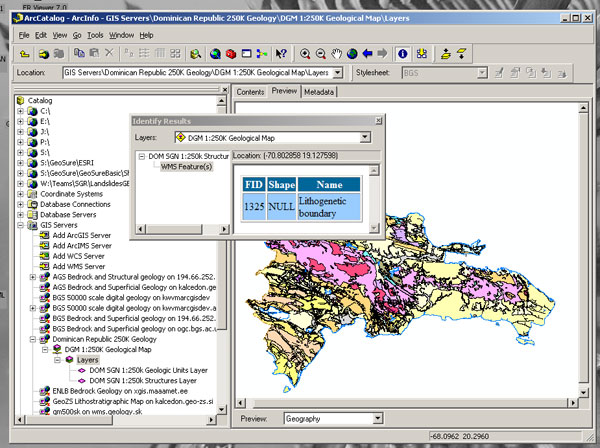
The above screen-shot shows a number of WMS (GIS Servers) listed in the left hand menu. These are services that have previously been added to ArcCatalog. To retrieve layer name information, preview, and do GetFeatureInfo requests, you must first double-click on the layer name. This will re-query the service and retrieve only active layers at the time of your query.
Section last modified: 19 January 2010