


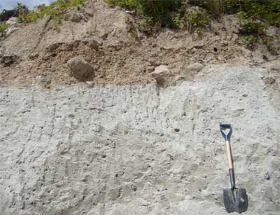
Till
When a glacier melts, all of the rock  , sand and mud that it was carrying gets left behind. Geologists call this mixture of sediment till.
Till might be only a metre or two thick or tens of metres thick depending on how much debris was in the ice. Several tills can build up if glaciers advance and melt several times.
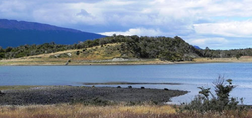
Blocks of ice left behind in the till slowly melt creating depressions called kettle holes. These can fill with water  creating kettle lakes.
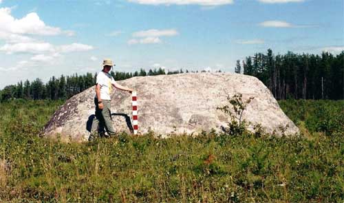
An erratic is a boulder that has been carried a very long way by a glacier. Erratics are a different kind of rock than the local bedrock.
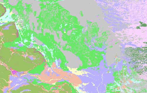
Drumlins are asymmetrical hills of till or rock. Drumlins point in the direction that the ice was flowing.
The composition of till reflects the geology of the region the ice has flowed over. This means that till from different parts of a large glacier will contain different types of rocks and minerals. Sometimes precious minerals in till can be traced back to their bedrock source. Geologists compare maps that show where there are high concentrations of minerals like gold or platinum with maps that show which direction the glacier moved. This is called drift prospecting.
« Back 
