


Meandering rivers
Rivers flowing over gently sloping ground begin to curve back and forth across the landscape. These are called meandering rivers.
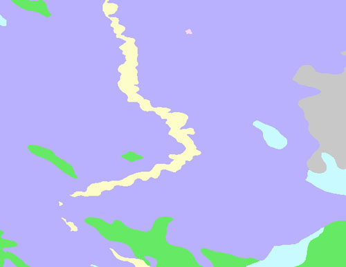
Meandering rivers erode sediment  from the outer curve of each meander bend and deposit it on an inner curve further down stream. This causes individual meanders to grow larger and larger over time.
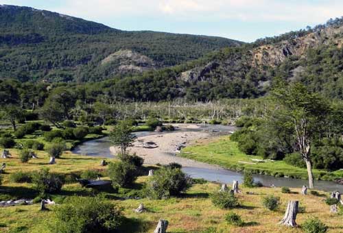
Meandering river channels are asymmetrical. The deepest part of the channel is on the outside of each bend. The water  flows faster in these deeper sections and erodes material from the river bank. The water flows more slowly in the shallow areas near the inside of each bend. The slower water can't carry as much sediment and deposits its load on a series of point bars.
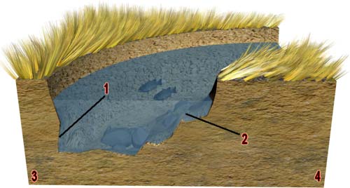
Click to view larger and see the legend.
- River erodes the outer bank of a meander
- River deposits sediment on the inner bank of a meander
- Erosion
- Deposition
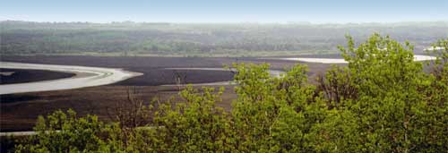
Oxbow lakes form when a meander grows so big and loopy that two bends of the river join together. Once the meander bends join, the flow of water reduces and sediment begins to build up. Over time oxbow lakes will fill with sediment and can even disappear. The point where the two bends intersect is called a meander cut-off.
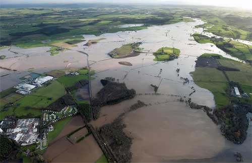
The low-lying area on either side of a river is called a floodplain. The floodplain is covered with water when the river overflows it banks during spring floods or periods of heavy rain. Sediment is deposited on the floodplain each time the river floods. Mud deposited on the floodplain can make the soil really good for agriculture.
« Back 
